4/17 - Rest Day
Marshall and Jeff drive Megan up to Salt Lake and resupply. I fly into Hanksville for laundry and showers. The wind is from the south and the runway slopes to the south so south departure is preferred. However, this direction points directly into the large canyon formed by Muddy Creek as it cuts through the swell. There is plenty of room to make a 180 turn, I just have to do it right.
|
|
|
|
|
|
|
|
|


On my way back the wind is from the south and east. Not ideal!. I fly the south approach and do a low pass to get a sense of what the wind is doing. Over most of the runway it seems to be not so strong but over the northern end I'm pushed west. Or was that a gust? I choose to land from the south. Intimidated by the cliffs directly before the runway I'm high and fast. I touch my wheels down but am not sure that I have enough runway and go around. This is no ordinary go-around. I have to fly the departure in the narrowing canyon. I do another approach from the south and make it a low pass. I decide to try one more from the south. If this does not work I'll return to Hanksville then try again in the evening. I'm a little off center, and roll further than my first landing here, but I'm down safely.
4/18 - Segar's Hole attempt #1
Marshal, Jeff, and I get up early and trudge through Muddy creek to the mouth of Segar's hole. The day is cool and clouds above look as if they could bring rain. At the mouth we decide this is not the right day. We have heard how difficult this canyon is and we want to have everything aligned for the descent.
I fly Marshall down to Bullfrog and Jeff drives the car. I think we spent the afternoon relaxing. In the evening we drive out the Burr trail, find some good slick rock camping, and cook some good food.
4/19 - Capitol Reef and Page
We get up sort of early, drive to the plane, and fly over to southern capitol reef to survey some potential canyons. From there we proceed to Page, flying over the canyons of the Escalante which I have hiked several times. As we fly toward page Jeff starts to get sick. I have him fly the plane and he's fine. About 5 minutes out of page I take the plane and 1 minute later Jeff is puking. It is very windy and forecast to get windier. After the difficulties landing at H.S. I don't want to dry the narrow Bullfrog runway in a strong cross wind. We decide to stay in Page and rent a car. What's to do? Well, we stop at the library to check our e-mail, go to Glen Canyon dam for a tour (cancelled as soon as we step onto the dam into 40 mph winds and half the hats are blown away), and hike a little canyon just west of the dam. The canyon is interesting to me because I did maybe this one or one very near on a trip in the early 90s. |
|
|
|
|


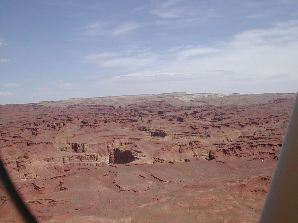
We spend the night in a little hotel and get up really early to avoid the day's turbulence. I preflight the airplane by flash light and take off at first light into smooth air. We fly over the northern portion of the Navajo reservation, enjoying beautiful scenery.
|
|
|
|
|
|


Landing was uneventful. I think we drove back to Smith fork and hiked through the narrows.